Take a slow walk along Victoria and Duke Streets in Cambridge, and Shakespeare Street in Leamington, and look closely. You’ll notice small clues everywhere that point back to how these streets first came together more than 150 years ago.
The towns we know today were laid out by surveyors in the 1860s, following the New Zealand Wars. But long before streets were formed and shops were built, this was already a place of movement and trade.
Mana whenua, Ngāti Koroki Kahukura and Ngāti Hauā, travelled by waka along the Waikato River, moving goods to markets in Auckland and beyond. The river was the first route, shaping how people lived, worked and connected.
Change arrived steadily. Rail arrived in 1884, opening up new ways to move people and products. Roads improved from the 1940s, and with each shift came new businesses, new buildings, and new ways for the town to function.
Cambridge’s history is still visible
The shops you see today follow these earlier patterns. Some sites have served the same purpose for generations. What has changed are the details, including materials, signage, and the vehicles parked outside, rather than the town’s underlying pattern.
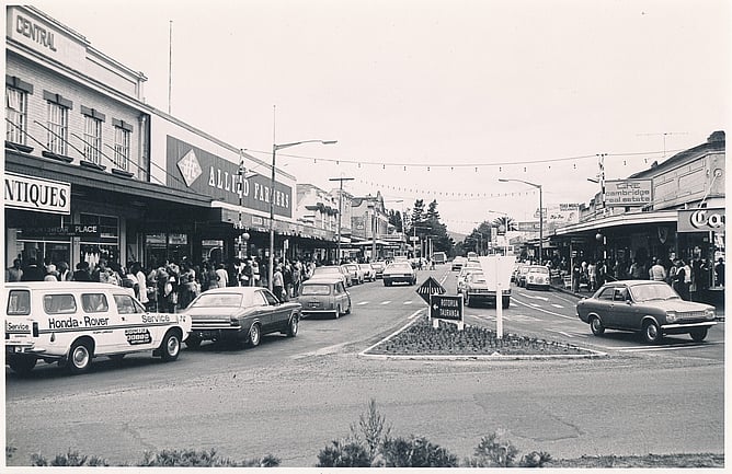
The historic photographs shown here capture everyday scenes from the 1880s through to the 1970s. Victoria Street with its early hotels, drapers and chemists. Duke Street as it evolved into a busy commercial spine. Leamington, once a separate town known as Cambridge West, had its own hall and identity.
Compare them with the streets around you now. What’s changed? What has stayed the same? Notice building shapes, street layouts and how people used these spaces.
The past is still present. You just need to look for it.
If this glimpse sparks your curiosity, the Cambridge Museum holds many more stories, objects and photographs that bring the town’s history to life.